JOHNSON VALLEY, CA
Zukiworld Rides The Hammer Trails.
Editor: Eric Bewley Story/Photo: Jason Hutchison
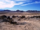
Johnson Valley, CA – For those of you who are not familiar with Johnson Valley area you might have heard of the infamous Hammers trails. Johnson Valley hosts not only these super aggressive trails created by the off road club the Tin Benders but an array of other terrain. Its pretty amazing how different the rock is in Johnson Valley. On the left (west) side of Bessemer road is sharp nasty volcanic rock. On the right side is sand stone type rock all the way to the granite like Hammers Trails. There is quite a bit to see and do in this valley and a small group from Zukiworld decided to go check out what this was all about.
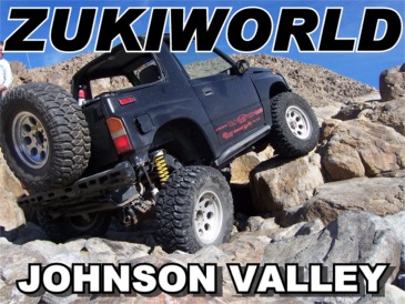
There are a lot of ways into the Johnson Valley area but we chose to tag along with a group that was heading out to the area for a Desert MC race. We camped off of Bessemer Mine Rd area near what is commonly referred to as the Rock Pile The Rock Pile is a staging event area for the Desert MC Hare and Hound Desert Race. We heard rumors of big partys and bands playing at the Desert MC event so this surely would offer plenty of night time entertainment.
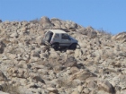
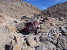
We found a great camp spot right behind Rock Pile. Saturday morning we had a turn out of 4 samurais and 2 trackers. Darren Wildgoody decided to try the rocks out right behind camp.
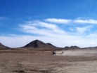
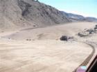
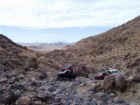
We headed across the desert 15 or so miles to the Means Dry lake which is they typical staging area for those interested in camping and exploring the Hammers Trails area. Once we headed across the means dry lake we discovered sand dunes on the back side of the first ridge.
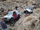
Straight passed the dunes and into the mtns off of means dry lake we found our first hammer trail. Although none of us know which trail we were on it was pretty fun until we hit the first waterfall. None of our rigs made it up the waterfall so we decided to go look for an easier Hammer trail, if one actually existed.
Our Second trail was around the mountain to the right if your pointing at Means Dry Lake and up a sandy wash and was quite fun. We were making great progress but the day wore on and we all decided since we werent sure which trail we were on, were it was going or if there was going to be another impassable waterfall for out little rigs.
A winch comes in handy on the Hammers trails
The only major breakage of the day was a broken frame on Darrens sidekick. A quick trail repair with a Toyota birfield that we found on the trail and Darren was running well enough to head off the trail to get the frame welded.
The rest of us decided to turn and head for camp before it got dark. We had a great time and the Hammers are very challenging to say the least. If your heading to the hammers here are some GPS locations of the trail heads these were posted by Lrp-wicky (Russ) so if they are wrong PM him!
Aftershock Trailhead – Hammers
Latitude Longitude
N 34.42280º W 116.43548º
N 34º 25.368′ W 116º 26.1288′
N 34º 25′ 22.1″ W 116º 26′ 7.7″
Claw Hammer Trail Head – Hammers
Latitude Longitude
N 34.43722º W 116.47455º
N 34º 26.2332′ W 116º 28.473′
N 34º 26′ 14″ W 116º 28′ 28.4″
Jack/Sledge Hammer – Hammers
Trailheads for the Jack Hammer and Sledge Hammer trails.
Latitude Longitude
N 34.41453º W 116.47440º
N 34º 24.8718′ W 116º 28.464′
N 34º 24′ 52.3″ W 116º 28′ 27.8″
Outer Limits Trail Head- Hammers
Latitude Longitude
N 34.45438º W 116.45183º
N 34º 27.2628′ W 116º 27.1098′
N 34º 27′ 15.8″ W 116º 27′ 6.6″
Sun Bonnet Trail – Hammers
Latitude Longitude
N 34.40317ºW 116.43345º
N 34º 24.1902′ W 116º 26.007′
N 34º 24′ 11.4″ W 116º 26′ 0.4″
Wrecking Ball – Hammers
Latitude Longitude
N 34.42258º W 116.47213º
N 34º 25.3548’W 116º 28.3278′
N 34º 25′ 21.3″ W 116º 28′ 19.7″

 ZUKIWORLD Online – Everything Suzuki Your Complete Suzuki Automotive Resource for Editorial, Tech, Events, Adventure, Racing, and Forum


