American Suzuki at The Top Of The World
ZUKIWORLD and American Suzuki on Moabs Top Of The World Trail -Junior
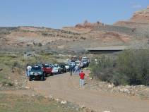
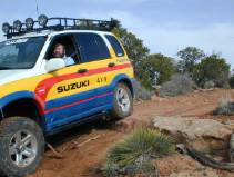
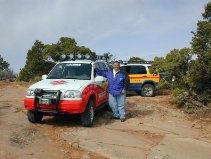
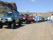
MOAB, UT -ZUKIWORLD joined with American Suzuki during the 2001 Easter Jeep Safari this past April, where we logged some 25 miles of off-roading. This being the first annual event, we were surprised by the draw. A respectable 20 rigs collected that morning where event shirts and lunches were handed out. This would prove to be one of the most complete model collections of any one brand wed ever seen. From Grand Vitara to the one that started it all, the Samurai, we nearly had them all with the exception of Suzukis new XL-7. 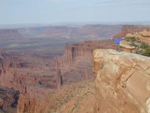
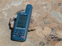
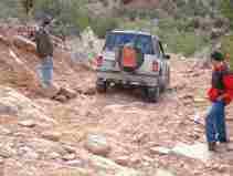
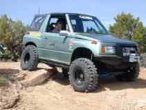
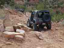
Eric Bewley and I had previously pre run and plotted the route on our Magellan Map 330s. After consulting Moabs local know it all and professional guide, Dan Mick (Dan Micks Guide Tours, 435-259-4567 or www.danmick.com ), wed put together one of the most scenic loops Moab has to offer. Even the 35-mile drive from town was scenic through the Colorado River valley and up to our turn off. Destination, Top of the world. Wed rated this loop a 3+ using Moabs standardized rating system. It truly depends on your vehicle and your personal driving skills, and how much body damage youre willing to endure. To give you an idea, a nearly stock Sidekick made the trek without major incident. It rubbed, it bumped, and the driver had to work at it. But they made it. Here our Sidekick driver makes his way down Rose Garden Hill.
Leaving town we headed north where we made a right on highway 128. Now heading east, we made our way through the Colorado River valley some 30 miles to Dewey Bridge. You cant miss it. Theres an old single lane wooden bridge paralleling the newer concrete bridge. Completed in 1916, Dewey Bridge is now closed to foot traffic only. Take a moment to read the historical marker describing the bridges history.
 At the bridge, we made a right onto a dirt road called Entrada Bluffs Rd. We elected to air down and lock up here at the turn out, rather than block the road later. Additionally, we reset our GPSs odometers and those without GPSs reset their vehicles odometers. The actual trail were on is known as the Kokopellis trail, named after the Indian fertility god of years past. Theres some very interesting history surrounding Kokopelli. Just about every shop within the city of Moab has something of reference to this folk god. Heading South on Entrata Bluffs Rd. we make our way to 5.3 miles where we turn right twice following the signs.
Here the trail begins to narrow and takes on a couple of easy to moderate challenges as it leads us to The top of the World. Youll know youre on the correct trail when at 5.7 miles you pass through a gate.
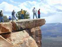
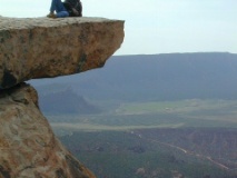
At 8.6 miles we made another right. The Top of the World trail is a loop at this point. You can actually go either left or right, but I believe the rule is to stay right. At 9.6 miles you will have reached the ridge. Do yourself a favor, and approach the ledge with extreme caution. And never, ever, drive all the way to the edge. Don not leave here without taking plenty of pictures. Completing the mile loop at the top, we continued (East of where we came in) until it met back up with the main part of the trail at 10.7 miles. Make a right and begin your decent down the trail wed earlier come up. Once we reached Entrada Bluffs Road, now 14.0 miles, we made a right where we continued on Entrada Bluffs Road to Rose Garden Hill. At mile 20.0 continue straight. The trail snakes along a canyons edge offering scenes no artist can imagine. We reached the top of the hill at 23.3 miles.
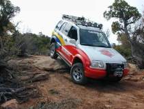
Wed elected an unconventional way to get to Rose Garden Hill, from the back. Most access it from Onion Creek, but wed of missed the Top of the World and that would have change d the entire run. Now if you were thinking its probably because we were unwilling to go up Rose Garden Hill, well, youd be partially right. Some in our group were informed this was a moderate run intended for SUV types. They soon discovered that going down it was plenty challenging.
Once wed cleared the hill, now 23.7 miles, it was easy sailing from here on. We simply continued on to a major intersection at 26.8 miles and made a right where we continued out Onion Creek and on to highway 128. We made a left on the highway and proceeded to town. If you ever wanted to take a break from all the boulder banging, axle dragging 4 plus trails, consider this route. Its enjoyable for all, and offers the absolute most beautiful scenery Moab has to offer.
GPS waypoint coordinates. Intersection/turns only taken from our Magellan MAP 330 GPS’s Start (miles) Lat Lon Dewey Bridge (0) 38° 48 37.9 109° 18 16.0 Right turn (5.3) 38° 46 14.8 109° 14 57.2 Bear right (8.6) 38° 43 57.6″ 109° 15 39.4 Top of the World (9.6) 38° 43 15.2 109° 15 55.7 Right turn (10.7) 38° 43 57.6 109° 15 39.4 Right turn (14.0) 38° 46 14.8 109° 14 57.2 Go straight (20.0) 38° 43 35.9 109° 12 02.9 Bottom of hill (23.7) 38° 43 09.9 109° 11 06.8 Major intersection (26.8) 38° 41 20.6 109° 13 12.4

 ZUKIWORLD Online – Everything Suzuki Your Complete Suzuki Automotive Resource for Editorial, Tech, Events, Adventure, Racing, and Forum

